Notice of Availability of Outer Continental Shelf Official Protraction Diagrams
The Bureau of Ocean Energy Management (BOEM), in accordance with its authority and responsibility under the Outer Continental Shelf Lands Act, is announcing the availability of ...
The Bureau of Ocean Energy Management (BOEM), in accordance with its authority and responsibility under the Outer Continental Shelf Lands Act, is announcing the availability of new World Geodetic System 1984 (WGS84)-based Outer Continental Shelf (OCS) Official Protraction Diagrams (OPDs). These OPDs depict geographic areas located on
( printed page 44871)
the OCS offshore American Samoa covering the extent of the area identified for further consideration for potential OCS mineral leasing and environmental analysis in BOEM's American Samoa Area Identification that was finalized on October 15, 2025. These diagrams may be used for the description of potential OCS mineral lease sales off of American Samoa. Additional OPDs for areas offshore American Samoa not included in the October 2025 Area Identification are expected to be published in the future.
Use this for formal legal and research references to the published document.
91 FR 44870
Web Citation
Suggested Web Citation
Use this when citing the archival web version of the document.
“Notice of Availability of Outer Continental Shelf Official Protraction Diagrams,” thefederalregister.org (July 17, 2026), https://thefederalregister.org/documents/2026-14480/notice-of-availability-of-outer-continental-shelf-official-protraction-diagrams.
 experience.arcgis.com/experience/eb21d5af8cf74c93b139c38c5b4163d1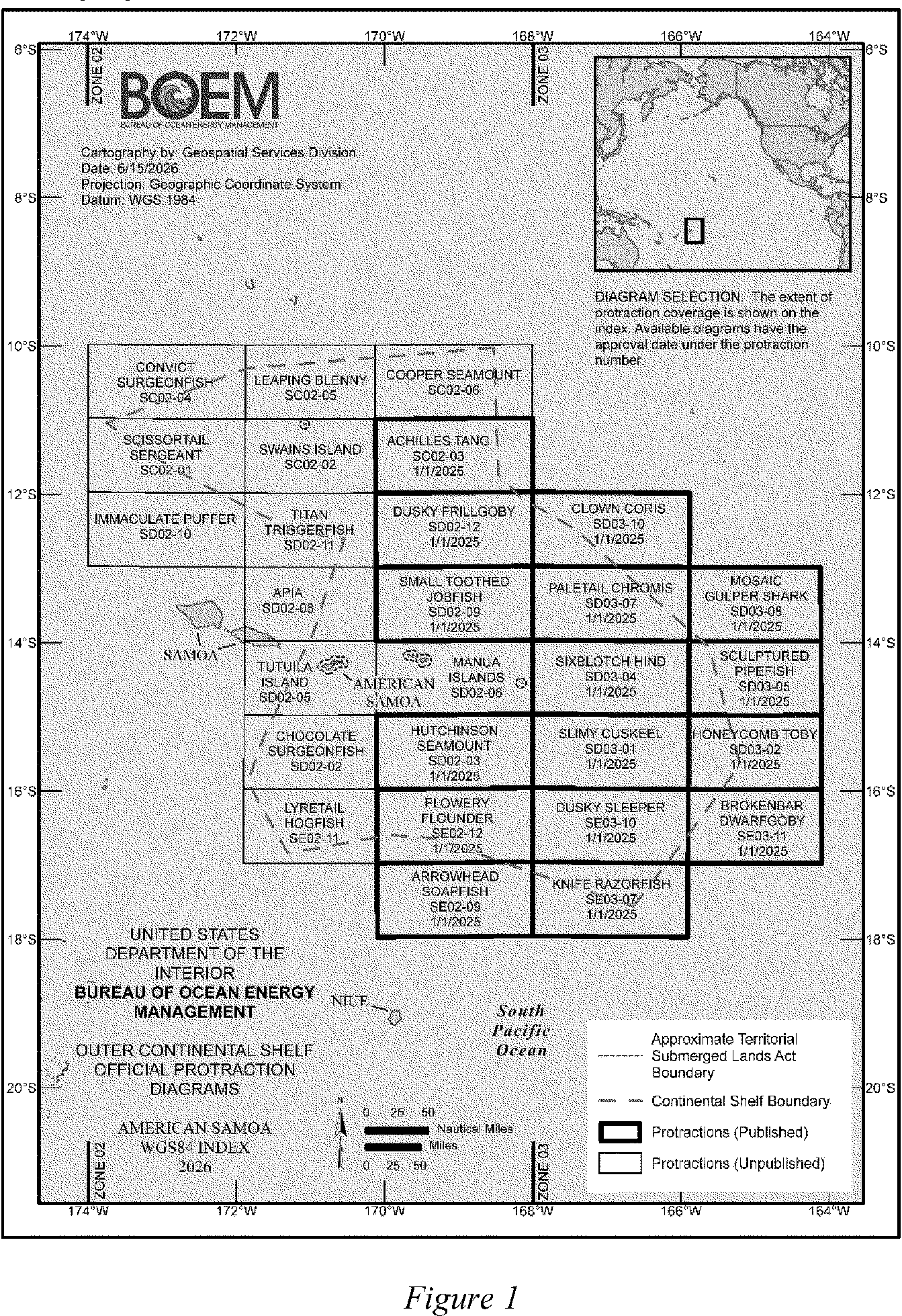
 43 U.S.C. 1331